
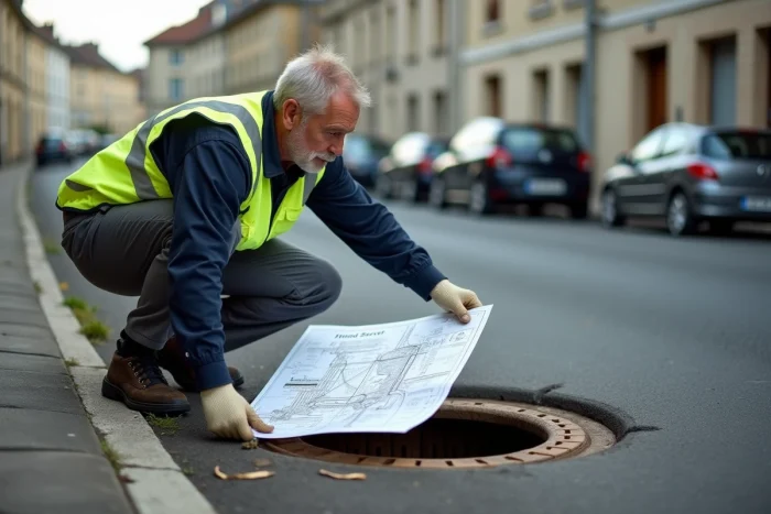
Before purchasing land or starting connection work, accurately locating the sewage pipes that run under the plot or along the property line is a technical step that is often underestimated. The collective sanitation network plan is not a unique document: it depends on the competent authority, the level of georeferencing of the pipes, and sometimes the date of installation of the network.
Understanding who holds this data, in what form, and with what reliability limits helps avoid weeks of unnecessary procedures.
See also : How to Choose a Reliable Professional for Your Work Safely
Reliability of sanitation plans: what georeferencing changes
Not all network plans are created equal. The anti-damage regulation (DT-DICT) has required for several years a class A georeferencing for new or renewed networks, which means a location accuracy of about a few tens of centimeters.
In contrast, pipes installed before this requirement often appear on old plans, sometimes digitized from paper surveys. Their accuracy can be significantly lower, with discrepancies of several meters between the indicated layout and the actual position of the pipe.
Related reading : How to Boost Your Business Growth with Innovative Business Solutions
This distinction has direct consequences. A class A plan allows for sizing a connection project without prior additional investigation. A class B or C plan, however, generally requires additional field investigations (radar detection, drilling) before any excavation, which extends the timeline and budget. When you obtain a plan from your local authority, always check the precision class indicated in the box or the document’s metadata.
Obtaining a map of the sewage network suitable for your project therefore requires knowing how to interpret this information, and not just retrieving a PDF file.

Inter-municipal GIS portals: access the sanitation plan online
Since 2023-2024, an increasing number of EPCI (public intercommunal cooperation establishments, such as communities of municipalities, urban communities, and metropolises) are publishing their sanitation data on GIS portals accessible to the general public. These mapping platforms allow you to activate a “sanitation” or “wastewater” layer and visualize the layout of the pipes at the scale of the cadastral plot.
The operation is similar from one portal to another:
- You enter the address or cadastral reference of your land in the platform’s search engine.
- You activate the thematic layer “sanitation networks” or “wastewater” among the available data.
- The layout of the pipes appears overlaid on the cadastral background or aerial photograph, sometimes with the diameter, material, and direction of flow.
The SIIG in Gironde or the portals of metropolises like Lyon or Rennes offer this type of access. However, the available data varies from one territory to another. Some intercommunalities only publish a rough layout, while others provide detailed technical attributes.
Public access or secure access
Two levels of access often coexist on these portals. Public access displays the cadastral background, local urban plans (PLU), and sometimes the main networks. Secure access, reserved for member local authorities and their service providers, grants access to all layers, including non-collective sanitation or inspection chambers.
If your intercommunality has a GIS portal but the sanitation layer is not available for public access, send your request directly to the sanitation service of the EPCI. The data exists in the database, but its public dissemination is not systematic.
National collective sanitation portal and identification of the competent authority
The national portal on collective sanitation, managed within the framework of the Eaufrance information system, has recently been revamped. This new version improves the visualization of sanitation agglomerations, wastewater treatment plants, and their performance.
This portal does not provide a detailed plan of the pipes plot by plot. Its usefulness is different: it allows you to identify the competent authority for sanitation in your municipality (municipal management, intercommunal union, private delegate) and to know the type of service management. It is this authority that you will need to contact to obtain the precise plan of the network near your land.
Tele-service “networks and pipes” from INERIS
The national tele-service “Networks and Pipes,” hosted by INERIS, constitutes another entry point. Originally designed for work declarations (DT-DICT), it lists the network operators present in a given geographical area. By providing the footprint of your project, you obtain the list of concerned operators, including the one managing the sanitation network.
The identified operator is then required to provide you with the plans of its networks within a regulatory timeframe. This procedure is mandatory before any construction project near buried pipes.
Direct request to the sanitation service: process and limitations
When online portals do not cover your municipality or the published data lacks precision, a direct request to the technical service remains the most reliable route. Depending on the size of the municipality, the competent service may be:
- The road or sanitation service of the town hall for small municipalities under direct management.
- The intercommunal sanitation union for shared territories.
- The private delegate (such as Veolia, Suez, Saur) if the network management has been delegated.
Specify in your request the exact cadastral reference of the plot, the nature of the project (construction, extension, connection), and the expected level of detail. A plot plan with connection dimensions is not the same as a zoning plan for sanitation, and the two documents are not issued by the same contact person.
Variable timelines and costs
Field feedback varies on this point. Some local authorities send a plan excerpt within a few days, free of charge. Others charge for the service or require an on-site appointment with a technician. There is no national pricing framework for providing a sanitation network plan to an individual.
The sanitation zoning plan, however, is included as an annex to the PLU and remains available for free consultation, including on the Urbanism Geoportal. This document distinguishes areas subject to collective sanitation from those under non-collective sanitation, but it does not show the layout of the pipes.
The mapping of the sewage network relies on a combination of sources: local GIS portals, national tele-service, direct request to the manager. No single tool currently centralizes all sanitation plans at the territorial level. The first useful step remains to identify the operator via the national portal, then to request the detailed plan from the right contact, checking the precision class of the document received.